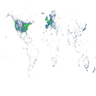
現在有很多相機有內建 GPS,每次照相時相片的 EXIF 會多記錄拍照地點的經緯度。之前我們從
flickr 收集了大量 geotagged 也就是有經緯座標的照片,從中找出所謂的「地標」,並讓電腦記得這些地標長什麼樣子。接著如果有一天,有一張新照片進來(可能是沒有 geotag),系統可以自動認出這張照片是那個地標,甚至這個地標在那個城市、那個國家。這中間牽扯到怎麼從照片認照片、ontology tree 的建立等等問題,不過這並不是我想說的重點。在這個過程中,我畫了一些圖,想跟大家分享一些比較有趣的:
這是把我們 mirror 來的資料按經緯度畫出來,顏色越偏紅表示照片數越多(指數成長)
這是舊金山金門大橋 :D 對照
空照圖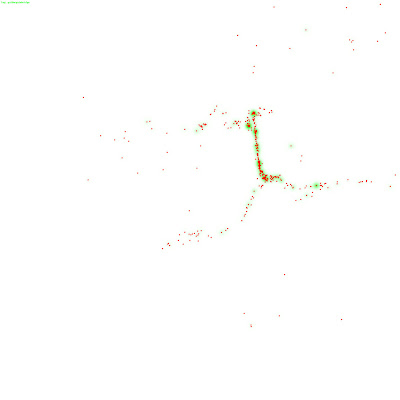
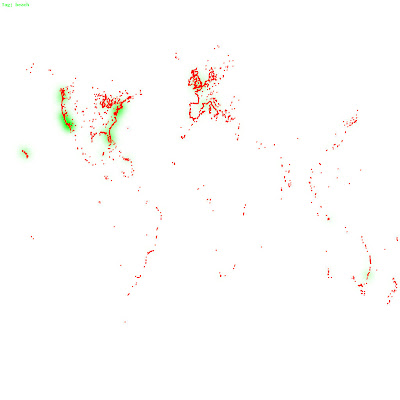
這是那些照片中,有被標上「beach」的
3 則留言:
I was reading some of your articles on this website and I conceive this web site is very instructive. 바둑이사이트
When it comes to divorce in the Garden State, securing the expertise of a knowledgeable divorce lawyer new jersey is essential for a smoother transition and fair resolution.
bankrupcty lawyer near me
immigrating from india to the us
preliminary protective order hearing virginia
Geotagged photos provide context, organization, and engagement by embedding location data. They can enhance personal memories, travel documentation, and historical records. However, they also raise privacy concerns, as they can reveal personal information. Inaccurate geotags due to GPS limitations or manual errors can be misleading, impacting the picture's context. Additionally, geotags can be misused for malicious purposes. To use geotagged photos responsibly, consider whether the location data is necessary, who will see the photos, and if privacy concerns outweigh the benefits. Manually adding location information to photos can be done without embedding geotags.
hampton virginia personal injury lawyers
張貼留言